
RICS and Coastal Monitoring
William Kirk • July 5, 2022
How do drone surveys enhance coastal monitoring
The Royal Institute of Chartered Surveyors (RICS) have recently published our joint article (working with Catapult Places for People and the Environment Agency along with RICS) on methods and processes for surveying and monitoring our coastal environment using drone and sensor technologies.
You can find the full article here.
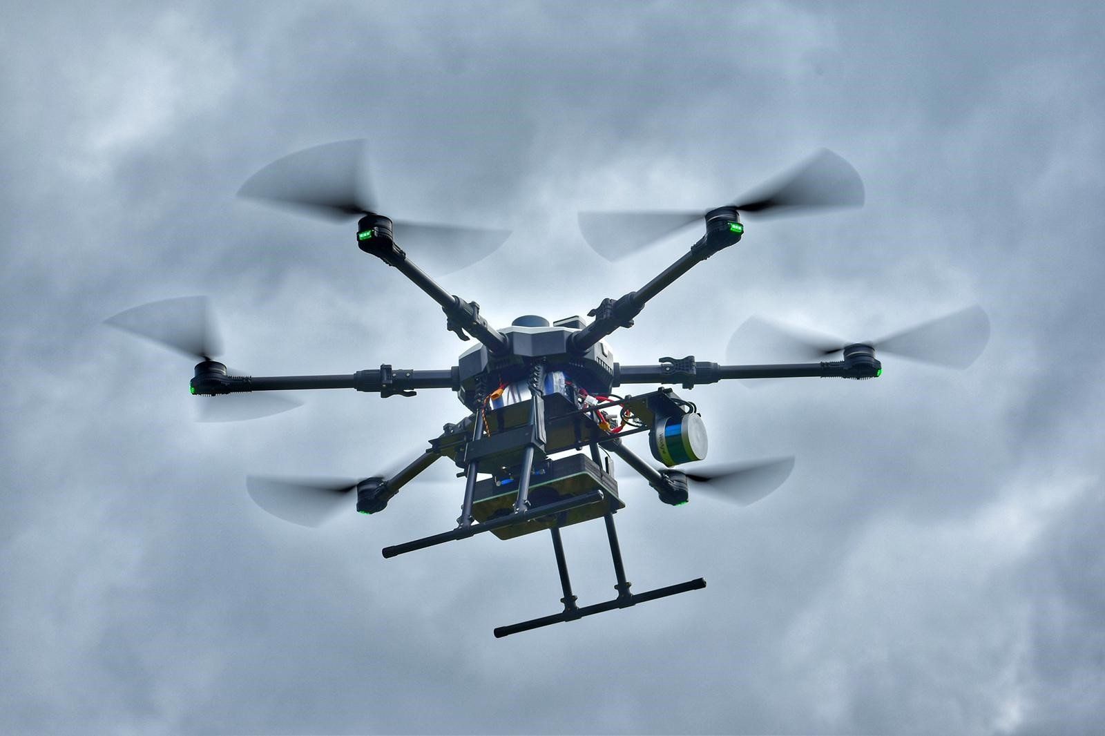
Surveyar continues to push the boundaries of climate science with the development of an integrated solution to measure and quantify Greenhouse Gas for both natural and industrial emission sources and sinks.

TRIG Funding - ECRA Embankment Climate Risk Assessment

Quantifying methane emissions using measurements is a pressing issue. In a recent commentary for the Nature journal ( https://rdcu.be/daGyw ), our partner, Prof Grant Allen, describes how aerial surveys, including aircraft and UAVs, can be used to quantify emissions for comparison with official inventories. Surveyar Ltd is proud to offer a solution to UAV-based greenhouse gas emissions surveys – see Gas Measurement (surveyar.co.uk) for further details and contact us if interested.

Major New Research Announcement for Surveyar

There is a lack of viable techniques to accurately measure greenhouse gas emissions and carbon sinks (fluxes) on a scale relevant to addressing the urgent Net Zero challenge.
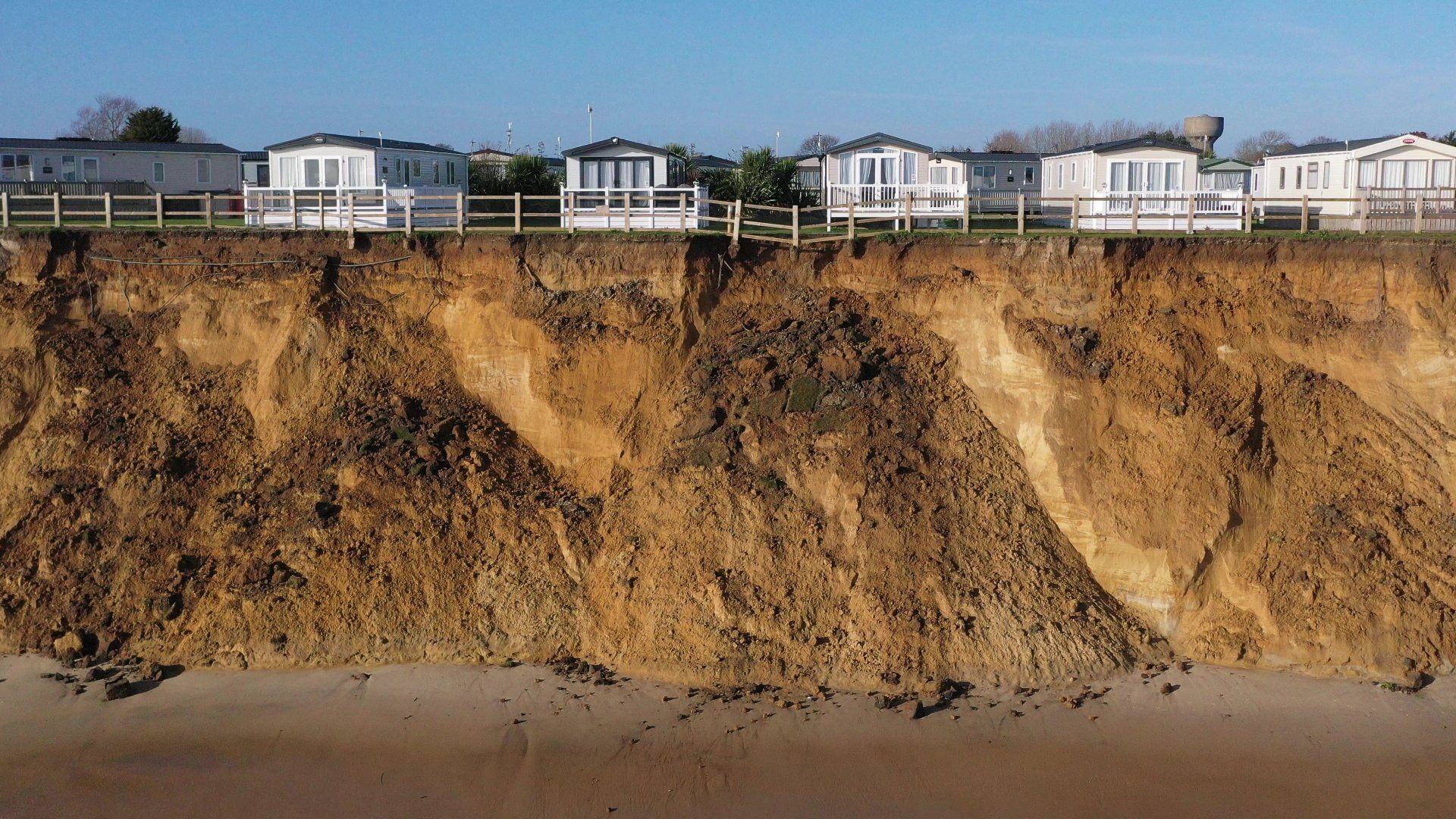
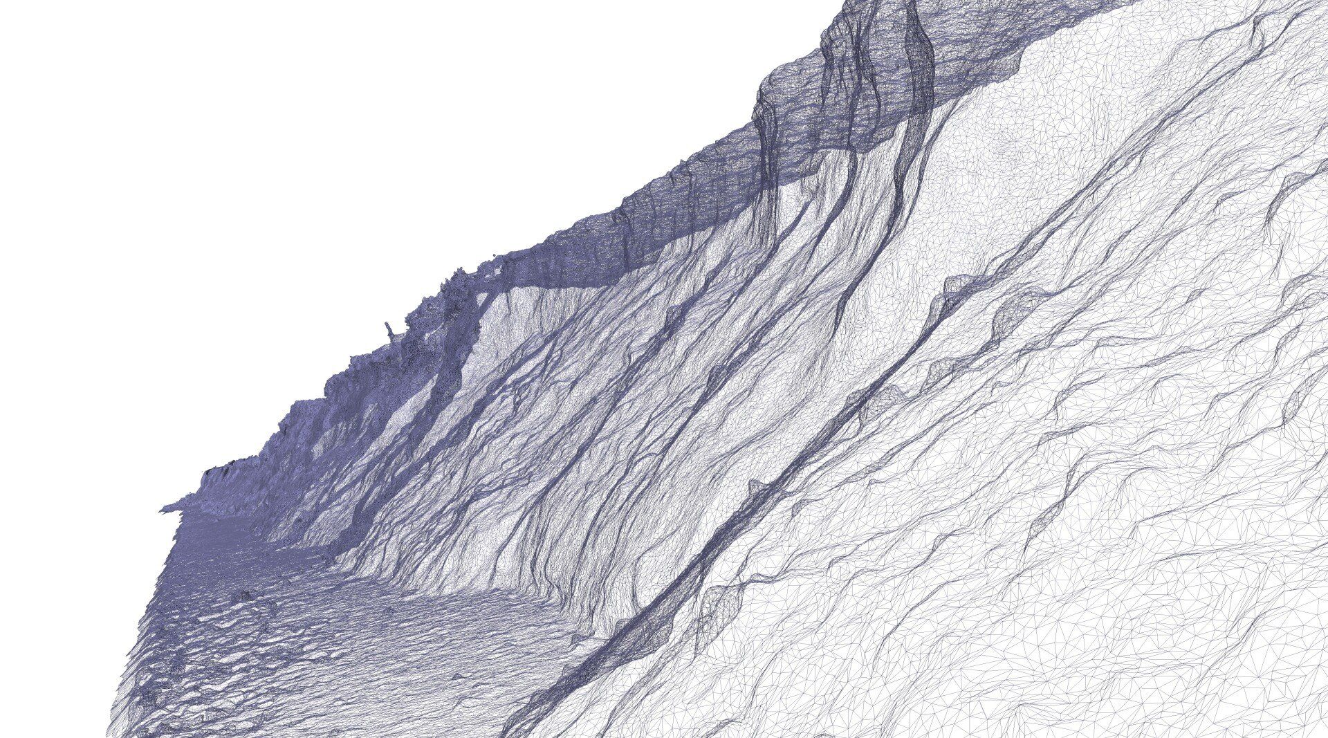
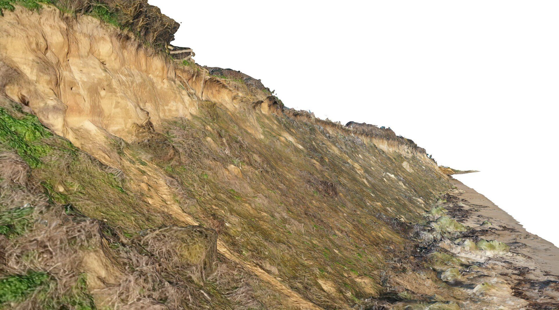
Drones Supporting Coastal Erosion Monitoring and Protection
DTM, DTM and CHM from Lidar

Welcome Professor Grant Allen

The first new start in the new Cranfield Office
Integrating technology for advanced remote survey