Blog Layout

Terrain Models

William Kirk • Jul 05, 2022

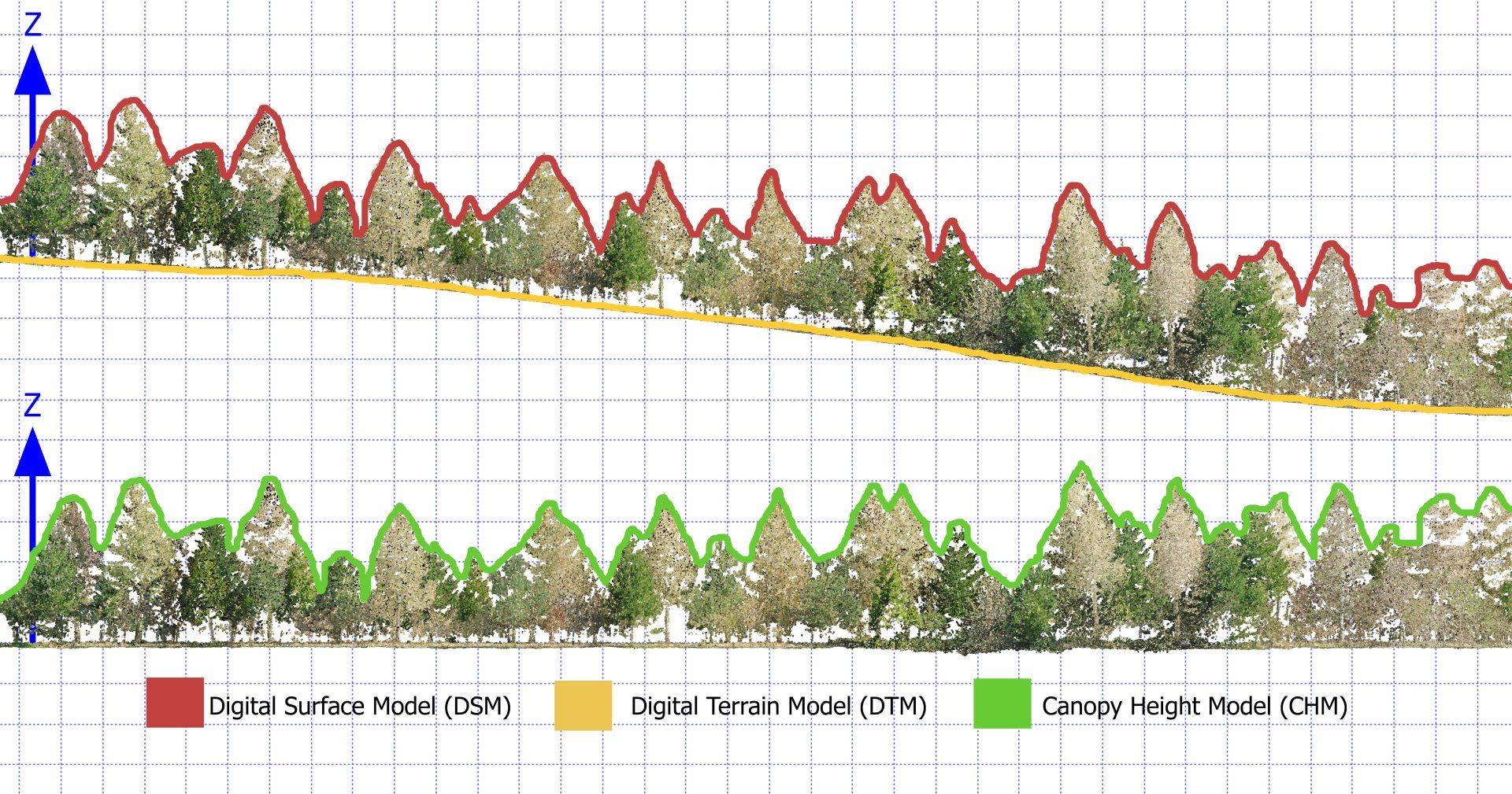
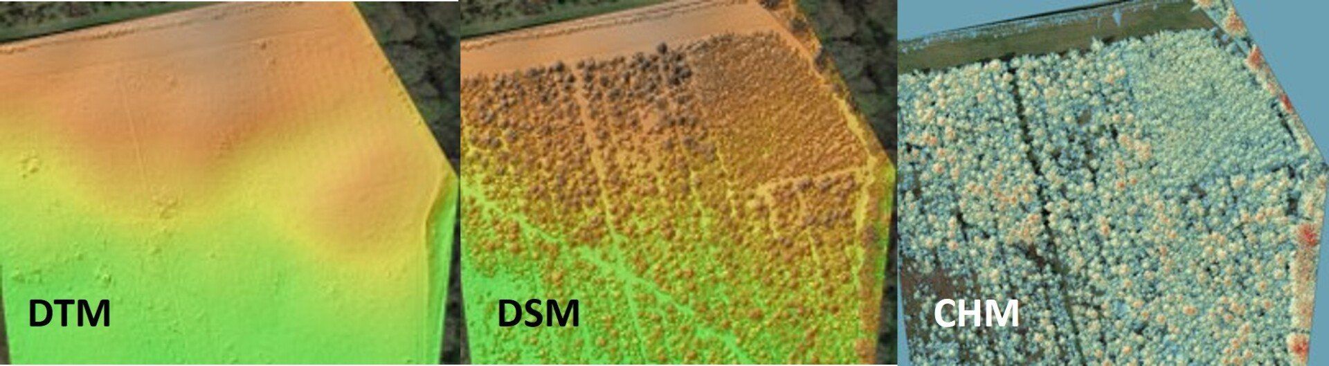
DTM, DTM and CHM from Lidar

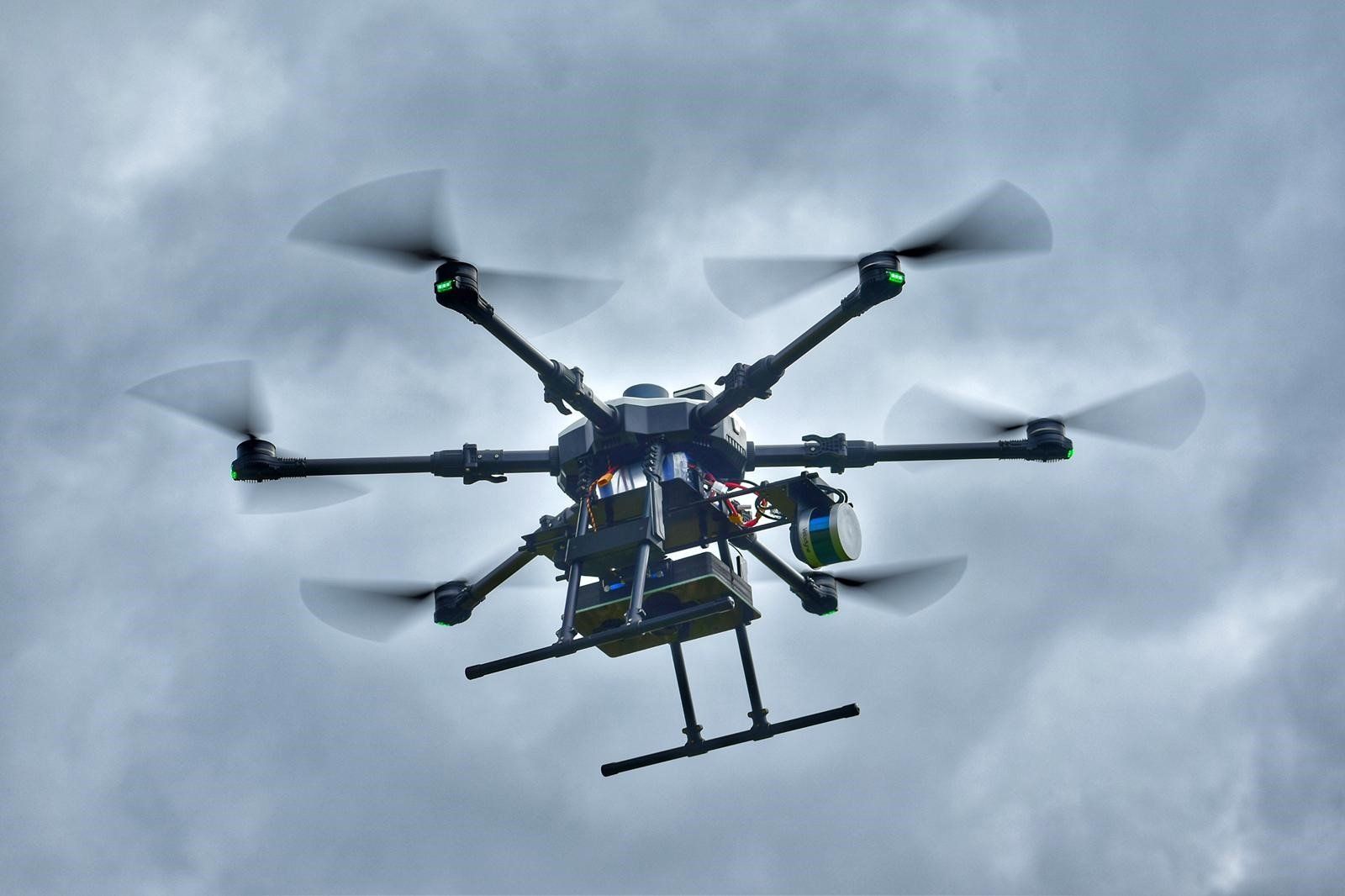
Our drone surveys using lidar sensing technologies can provide you with rapid, accurate and repeatable land profiles including in forested & vegetated areas, as well as providing insights into the forests/vegetation themselves.

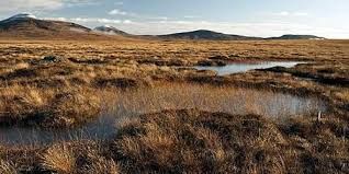
Lidar surveys also support identification of land features such as archaeology, drainage and man made structures.

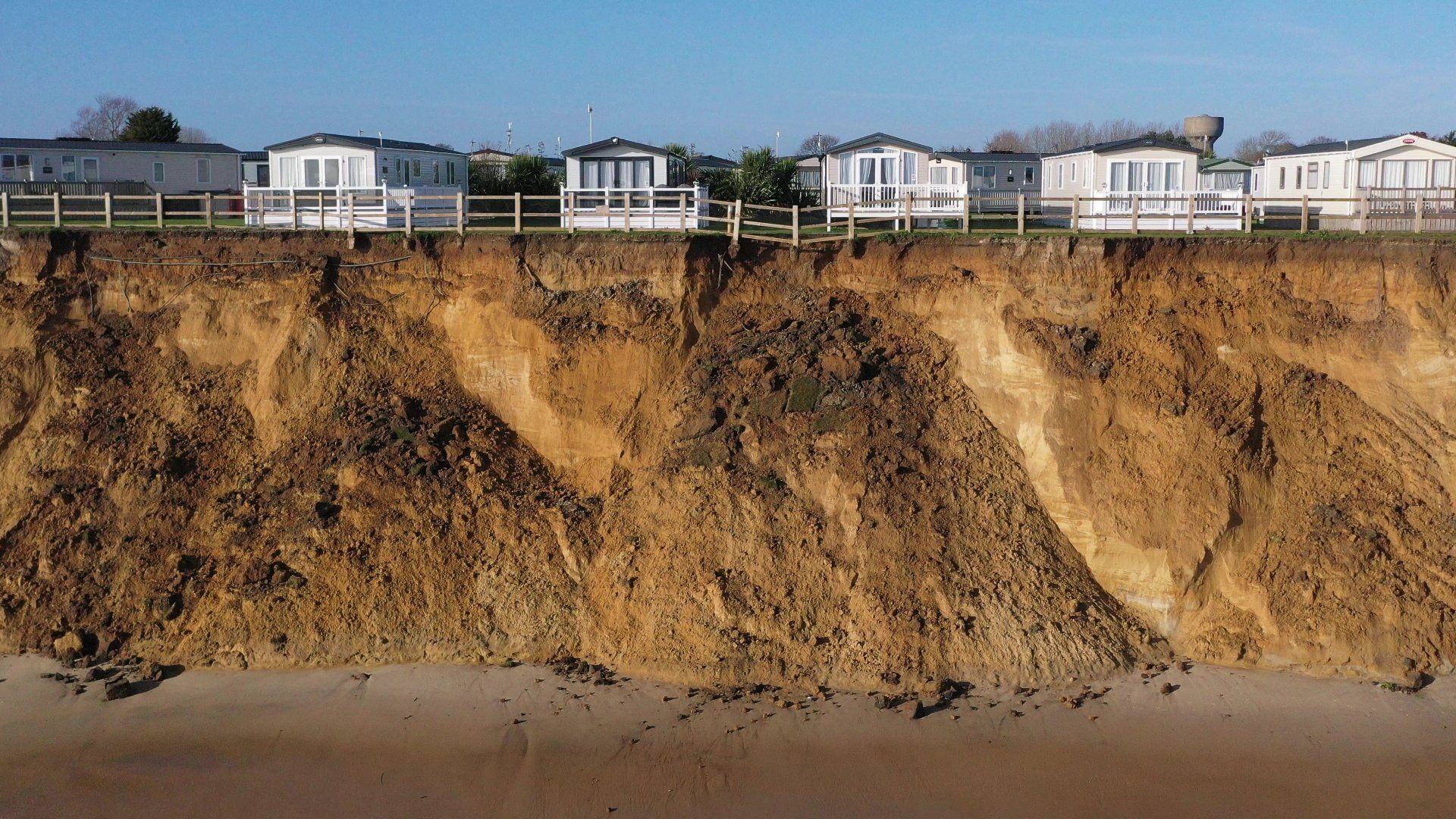
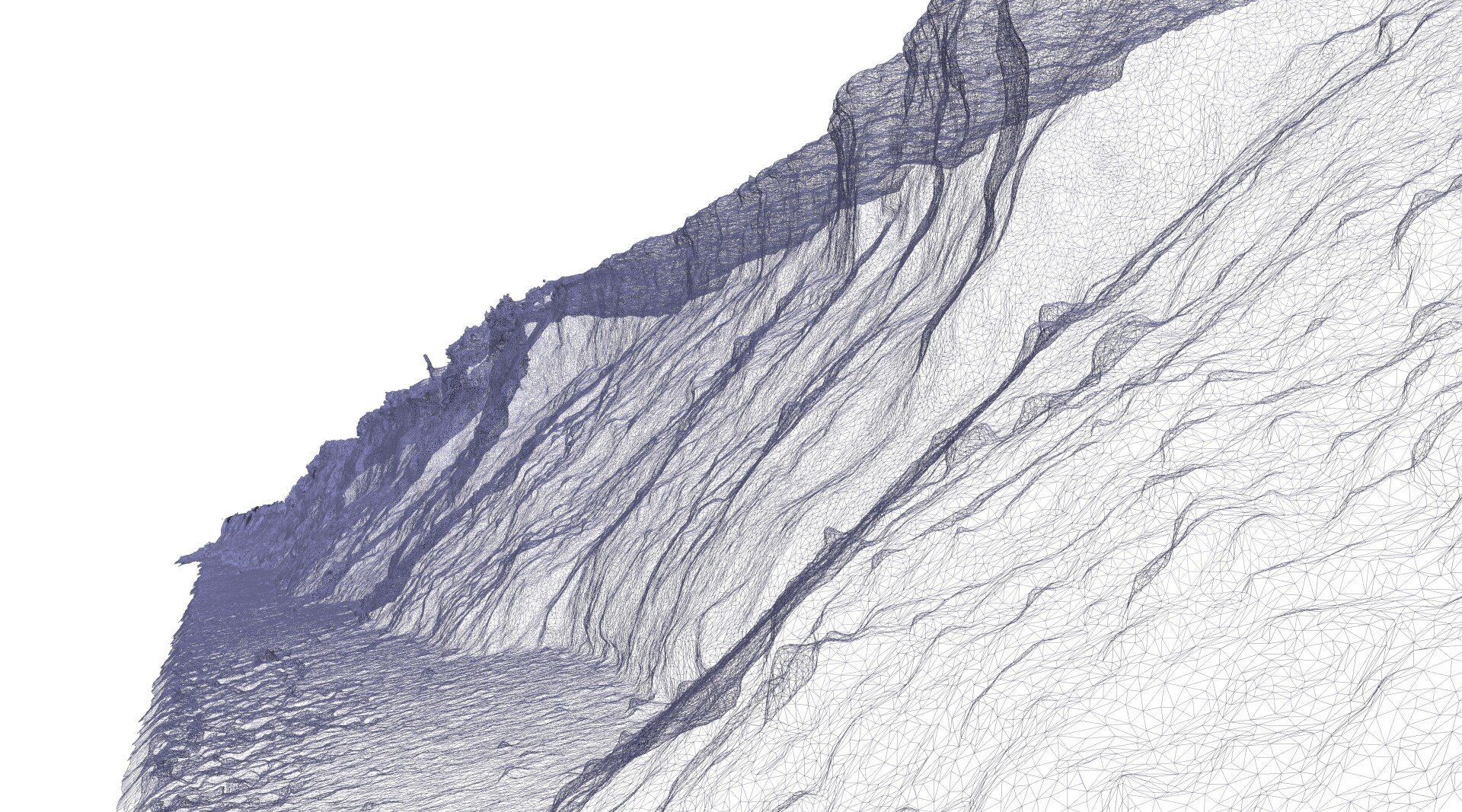
Surveys at different times can also be used to calculate volumetric changes in land and vegetation as a consequence of activities in farming, landfilling, quarrying, erosion and development.

Outputs such as raster layers, point clouds and meshes can easily be integrated into GIS and other packages for easy analysis alongside your existing data.

Our Lidar surveys from drone platforms can achieve c.500points/m2 with <5cm real-world accuracy. Surveys provide a high level of coverage for any site, overcoming access issues which typically hinder ground based GPS survey. The key benefits in lidar use is the ability to produce digital surface, digital terrain and canopy height models (DTM, DSM and CHM), which cannot be produced using photogrammetry.

Lidar surveys can also be paired with high resolution imaging, multispectral and radiometric sensing to provide cost-effective high-level insights.


By William Kirk 22 Aug, 2023
Surveyar continues to push the boundaries of climate science with the development of an integrated solution to measure and quantify Greenhouse Gas for both natural and industrial emission sources and sinks.
By William Kirk 06 Jun, 2023
TRIG Funding - ECRA Embankment Climate Risk Assessment
By William Kirk 25 Apr, 2023
Quantifying methane emissions using measurements is a pressing issue. In a recent commentary for the Nature journal ( https://rdcu.be/daGyw ), our partner, Prof Grant Allen, describes how aerial surveys, including aircraft and UAVs, can be used to quantify emissions for comparison with official inventories. Surveyar Ltd is proud to offer a solution to UAV-based greenhouse gas emissions surveys – see Gas Measurement (surveyar.co.uk) for further details and contact us if interested.
By William Kirk 17 Mar, 2023
Major New Research Announcement for Surveyar
By William Kirk 07 Dec, 2022
There is a lack of viable techniques to accurately measure greenhouse gas emissions and carbon sinks (fluxes) on a scale relevant to addressing the urgent Net Zero challenge.
By William Kirk 05 Jul, 2022
Drones Supporting Coastal Erosion Monitoring and Protection
By William Kirk 05 Jul, 2022
How do drone surveys enhance coastal monitoring
By William Kirk 21 Sep, 2021
Welcome Professor Grant Allen
By William Kirk 21 Sep, 2021
The first new start in the new Cranfield Office
By William Kirk 30 Jul, 2021
Integrating technology for advanced remote survey
More Posts
Share by: