
BS15: Geology & Geotechnical
Closed, operational or waste/materials handling typically requires much survey and monitoring. This has typically been undertaken using ground based techniques with mixed quality of outcomes. Drones sensing and survey offers a cost effective solution to enhance coverage and accuracy, provide greater detail and to speed workflow.
Definition
Geological and geotechnical surveys are typically related to below ground conditions of soil and rock. Traditional survey techniques involve the use of drilling and geophysics. Works are typically undertaken for mineral prospecting or for development purposes.
Typical Surveys and Assessments
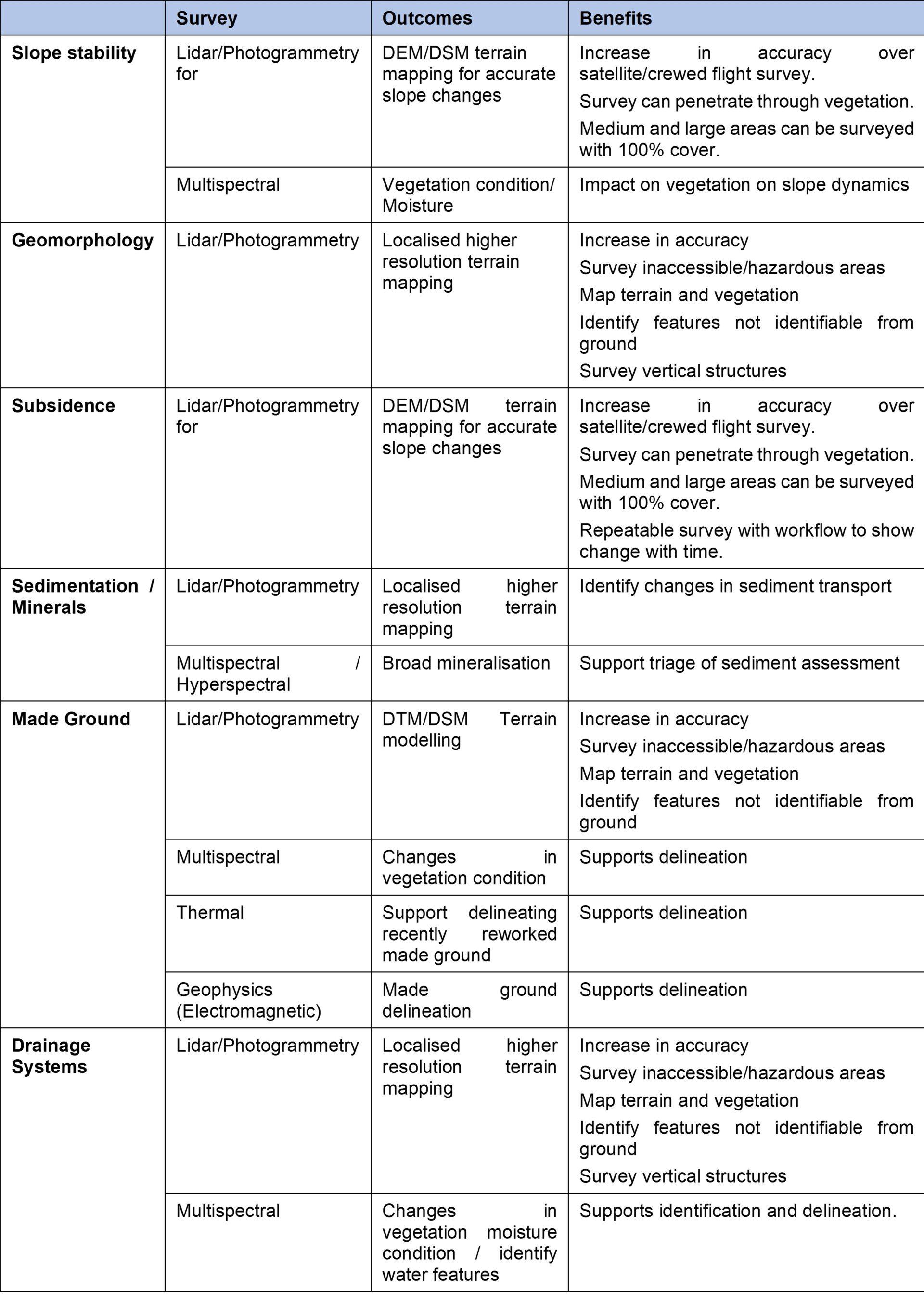
The following presents some examples of some traditional geology and geotechnical survey components and where drone survey can support enhancement.
Slope Stability
Slope stability assessment will typically require a topographical survey of the slope using ground based survey and the drilling of boreholes to obtain a description of the slope soils/rock along with testing of shear/compressive strength and moisture condition.
Drone survey can support a slope stability assessment through the application of hi resolution imaging, lidar and multispectral survey. This may be enhanced with aerial based geophysics (GPR, electromagnetics) where access allows. Lidar can provide an accurate digital terrain model (DTM) and a digital surface model (DSM) providing a true terrain across a slope with clear data on vegetation density. This is critical in supporting slope failure predictions and determining location for drilling and sampling. The multispectral survey solution could provide details of vegetation health, relative vegetation moisture content and identification of exposed soils/rock.
Geomorphology
Geomorphology can typically be developed from existing satellite lidar related data and tied to field based geological outcrops in supporting general prospecting or geological mapping. However, more refined geomorphology could be enhanced with higher levels of detail that could be obtained from lidar survey, particularly in nuancing older drainage channels.
Subsidence
River beds or exposed drainage channels will contain sediment transported from mine water discharge, erosion or pollution. Traditional survey methods employed are typically ground based where samples are obtained from various points and at different times to show any change. Testing of the samples provides an indication of sediment source and transport.
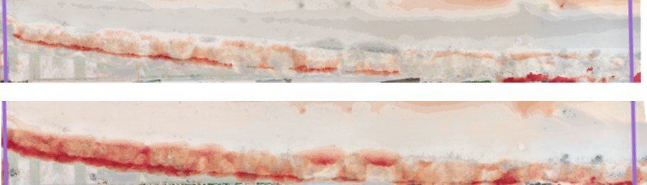
Drone survey can enhance sedimentation assessment using a combination of lidar to support any volume changes with time and through the use of multispectral or hyperspectral subject to generic identification of more ‘finger printing’ detection required. This can give a broad indication of the type and mineralisation of the sediment. Using both methods combines identification and transport. Further possible survey could be undertaken using electromagnetic geophysics. Much of the science on the application of hyperspectral is still in early development.
Made Ground
The identification of made ground (natural re-worked soils) or infilled ground (deposits of man made materials) is typically undertaken using drilling or trial pitting at specific locations. This is generally statistically suitable for smaller sites, but more problematic for larger sites. Made ground soils tend to be weaker and often unsuitable as a development foundation material.
Drone survey can be used to support the delineation of made ground using one or more techniques. The most obvious is hi resolution imaging which may reveal visual surface features which may give away the extent of made ground. However, multispectral survey is more revealing as can show the changes in vegetation from natural soil to made ground soil. Recently reworked ground will tend to have an increase in aerobic bacterial activity producing heat, so the use of thermal survey could be beneficial in identifying and delineating recently worked soils. Further, electromagnetic geophysical survey can be used on smaller areas (with limited vegetation density) to identify presence of made ground.
Drainage Systems
Historical and current surface drainage systems can often be difficult to spot, particularly if there is significant obscuring vegetation cover. Drainage systems are an important geotechnical consideration in foundation and development planning.
The combination use of high resolution imaging with lidar (which can penetrate vegetation) can be used to reveal drainage channels. The use of multispectral can be used to help identify if there is water or high moisture within the vegetation or exposed sections.
Minerals
Mineral prospecting is undertaken using a range of different triage mechanisms from satellite data to crewed flight data and then to ground based sampling/survey.
As highlighted above in sedimentation, drones could be useful in the general triage of larger areas (with hi resolution imaging and lidar) while identification of exposed soil/risk areas (as in river channels etc) could be undertaken using hyperspectral survey solutions. Hyperspectral, as stated, is still an evolving science.
How can Drone Surveys Help
Drone survey platforms with sensors such as lidar, photogrammetry, multispectral, thermal and geophysics can be used to provide greater survey coverage and provide insights that are not available from ground based survey, at a cost equivalent to ground based survey.
Key Considerations
The following re-iterates some of the common issues that surveyors are faced with and which should be considered when selecting an appropriate survey method.
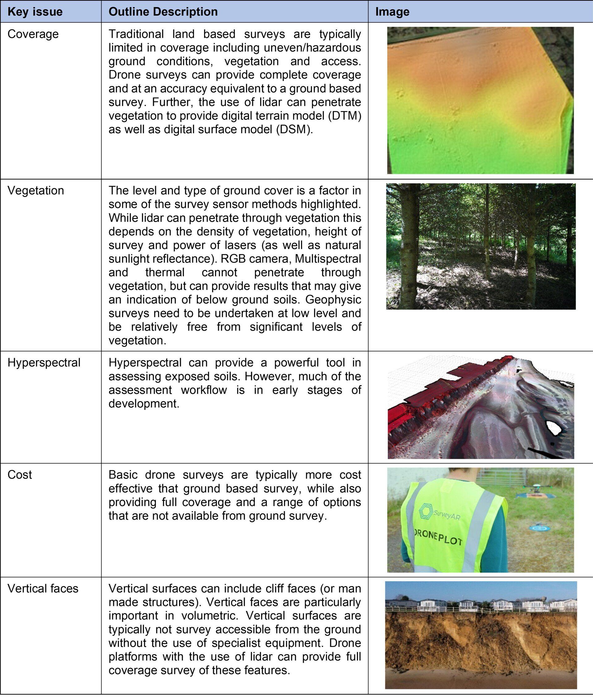
Drone based platforms are not infallible and have some limitations. These can include restricted flight areas and poor weather conditions. In many survey cases, it is useful to consider a number of survey tools from satellite data through to ground based survey.
Surveying Examples
Temporal volumetric survey in south east of England
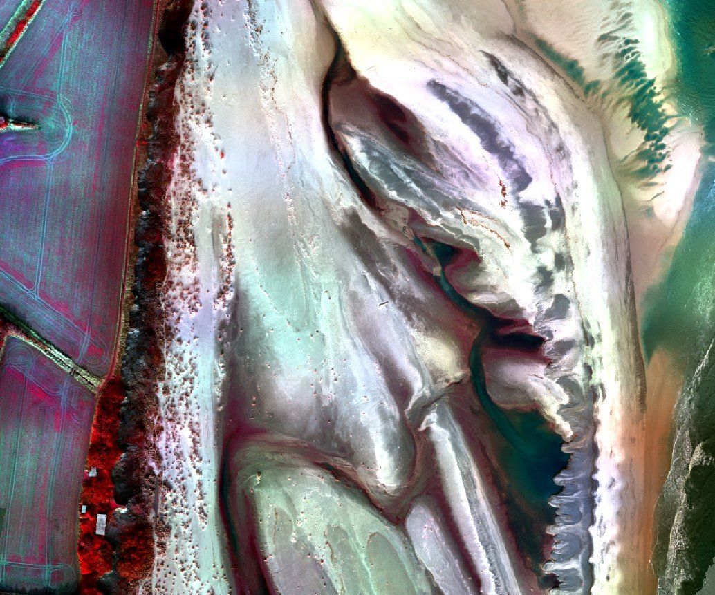
Multispectral survey of sedimentation process, south east England
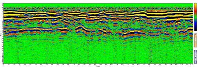
Magnetometer survey
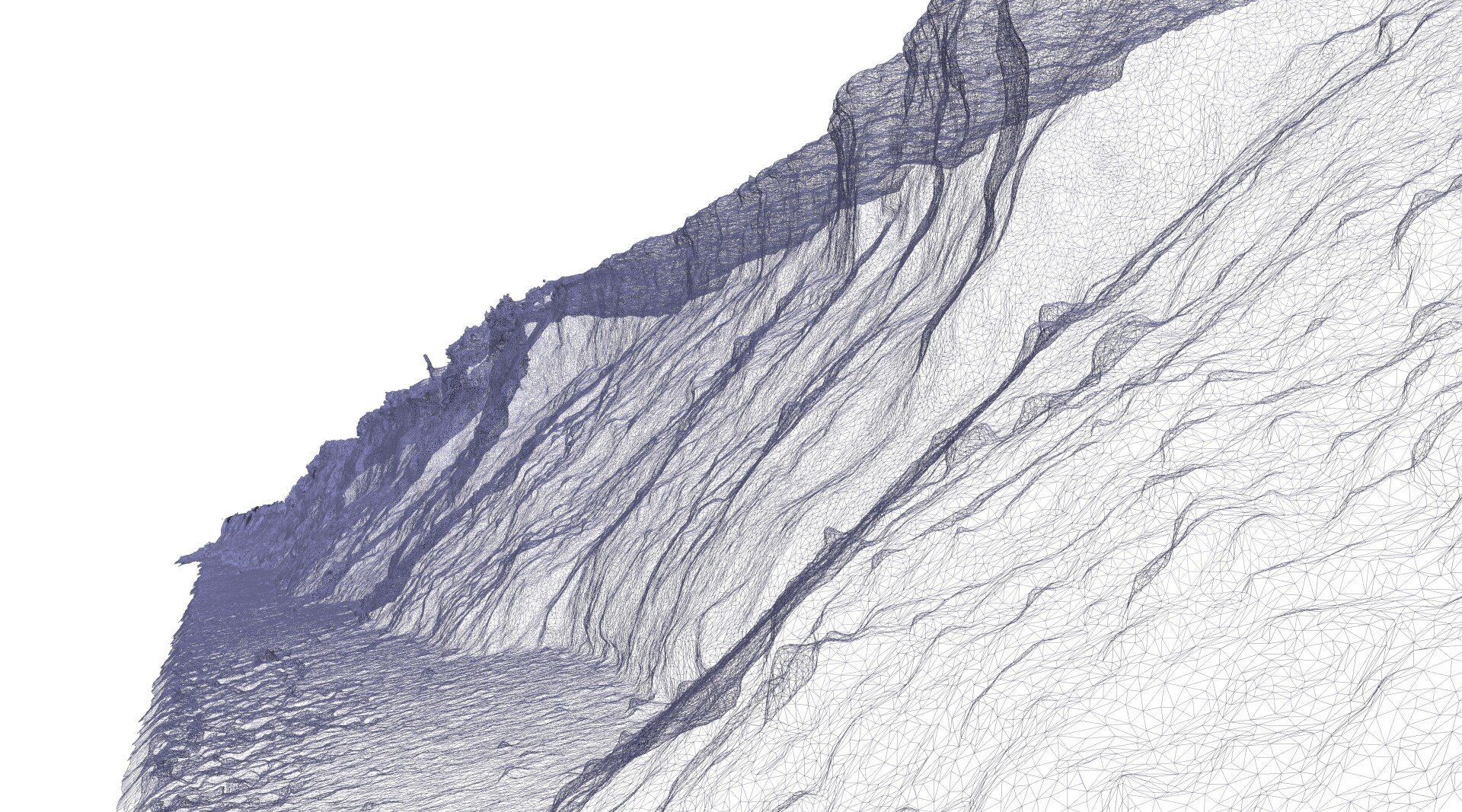
Lidar survey along a near vertical slumped face.
See Also